• Books 1. to 8. — "The Topic/Infrastructure Books" •
MAPS
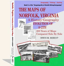
BOOK 2.
The Maps of Norfolk, Virginia
Evolution of A City
$14.95 e-book • $49.95 paperback
NORFOLK HISTORY PUBLISHERS • 2026 • 113 pages • 8.5" × 11"
T he last eight Encyclopedia of Norfolk books — Books 9. to 16. — separately cover specific regions of Norfolk, from the original town and borough to each area subsequently annexed. These books allow the reader to discover the history-geographies of the areas of almost every neighborhood in Norfolk, past and present.
Utilizing more than 3000 articles, maps, plats, photographs, and contemporary documents, these history-geographies allow the reader to explore every square inch of Norfolk as never before.
We also offer our one-of-a-kind, 20th-century history of the Jewish community in Norfolk:
 Learn more about it & Order It
Norfolk, Virginia: A Jewish History of the 20th Century $30
Norfolk History Publishers, 2001 222 pp., 8.5″ × 11″
Learn more about it & Order It
Copyright © 2008-2026 Norfolk History Publishers / Writers SuperCenter LLC
|
To order any of our books, please use our secure online order-form, call us, or send check or money order. |