Norfolk History
Books About Norfolk, Virginia's History and Geography … and More
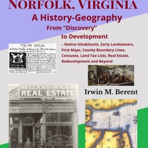
Norfolk, Virginia, From Discovery to Development: A History-Geography, the first book of Berent’s Encyclopedia of Norfolk, Virginia, History-Geography, covers Norfolk's remarkable beginnings as well as revealing its early landowners (recorded in tax lists, censuses, etc.) and describing early real estate development and later controversial Redevelopment, which made Norfolk the first city in the country to receive the federal loan and grant for urban renewal. The book also delves into the 17th- and 18th-century explorations of the New World, identifying the places in Norfolk into which Ralph Lane, Thomas Harriott, John White, John Smith and other explorers first ventured – including native America’s largest city in the area, Skicoac (whose exact location in Norfolk remains a mystery to this day).
The book also reveals evidence of Norfolk's earliest native inhabitants, the Chesepians, including later documents that refer to burial grounds and other sacred places, more-modern-day discoveries of artifacts, and several placenames suggestive of early Native American presence that survive to this day. Also described is the establishment of the region’s earliest counties, parishes, townships, and magisterial districts.
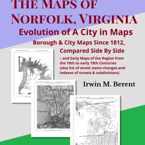
The Maps of Norfolk, Virginia: Evolution of A City (Book 2, Encyclopedia of Norfolk, Virginia, History-Geography) is not only an exquisite guide to Norfolk's history-geography through 200 years of maps and other documents but also an excellent guide to the entire multi-volume Encyclopedia of Norfolk Virginia History-Geography.
Showing in stunning detail the phenomenal evolution of one of America's most historic cities from its beginnings as a town to its current expanse, this "Every Square Inch of Norfolk" book presents an astonishing array of historic Norfolk-area maps spanning 200 years.
Arranged side by side and scaled to identical sizes, the maps make it possible to pinpoint every major change in the city, almost decade by decade. The book utilizes the most important detailed maps ever drawn of the entire city, beginning with the little-known War of 1812 map, the first great map to cover all the areas that make up today's Norfolk. And if you are reading other books in the Every Square Inch of Norfolk series, then this book is especially indispensable, as the maps in the book serve as the basemaps to which all the other books in the series refer.
Indeed, along with its extensive indexes and penetrating and meticulously researched textual background information, Evolution of A City is not only ideal for the study of every facet of Norfolk history and geography but also a significant contribution to American geography.
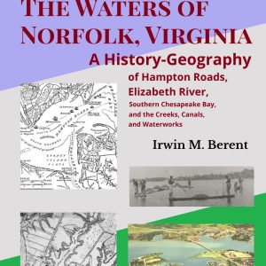
The Waters of Norfolk, Virginia: A History-Geography (Book 3, Encyclopedia of Norfolk, Virginia, History-Geography) covers in exhaustive detail the history-geography of the bodies of water that surround and run through Norfolk, Virginia, one of America’s most historic and important cities.
The Waters of Norfolk, Virginia encompasses Hampton Roads, Elizabeth River, Southern Chesapeake Bay, Willoughby Bay, Lafayette River, and the structures and activities associated with those waters, including its creeks, canals, waterworks, bridges, springs, wells, sewerage, lighthouses, quarantine, dredging, telegraph cable, tunnels, fishing, oysters, et cetera, all told through contemporary historic maps, photographs, articles, deeds, advertisements, books and other documents that make this a magnificent resource and reference for a great city’s watery character and heritage.
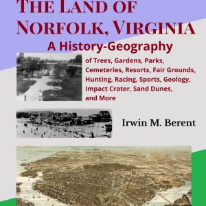
The Land of Norfolk, Virginia: A History-Geography (Book 4, Encyclopedia of Norfolk, Virginia, History-Geography) covers in exhaustive detail the history-geography of the land of Norfolk, Virginia, presenting a selective look at Norfolk's trees, soil, beaches, gardens, parks, cemeteries, fairgrounds, hunting, racing, and more, all described through contemporary historic maps, photographs, articles, deeds, advertisements, books and other documents.
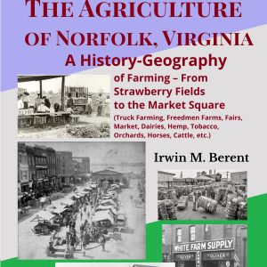
The Agriculture of Norfolk, Virginia: A History-Geography (Book 5, Encyclopedia of Norfolk, Virginia, History-Geography) reveals a forgotten time and place, when most of the land comprising today's Norfolk, Virginia, was farmland, and crops like strawberries and spinach dominated the landscape, supplying northern cities with the season's earliest produce.
The Agriculture of Norfolk, Virginia covers in exhaustive detail the history-geography of Norfolk's rural past – the produce that flourished, the farm workers who picked the produce, the Freedmen farms of the Civil War and the removal of squatters from them after the war, the agricultural fairs, the implements, horses, seeds and barrels that were used, the livestock raised, the dairies and orchards that were created, and the system of truck farming, market exchanges, wagons, shipping and railroads that moved produce from farm to Market Square and beyond, all presented through contemporary historic maps, photographs, articles, deeds, and other documents.
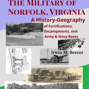
The Military of Norfolk, Virginia: A History-Geography (Book 6, Encyclopedia of Norfolk, Virginia, History-Geography) covers in exhaustive detail the history-geography of most of the forts and army and naval bases erected over the centuries to fortify Norfolk, Virginia, one of America's most historic and important cities – often pivotal in providing training and transport for troops, front row to the great Civil War battle between Monitor and Merrimack/Virginia that saw the end of wooden navies and the beginning of the ironclad, and home to the world's largest Naval Base.
Fortifications covered in The Military of Norfolk, Virginia include Fort Norfolk, Fort Barbour, and Fort Tar, the U.S. Army Base, St. Helena Naval Training Station, and the Naval Operating Base/Naval Air Station as well as smaller camps set up particularly during the War of 1812 and the Civil War, all documented through contemporary historic articles, deeds, maps, photographs, and other documents.
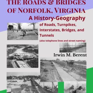
The Roads of Norfolk, Virginia: A History-Geography (Book 7, Encyclopedia of Norfolk, Virginia, History-Geography) covers in exhaustive detail the history-geography of the roads and bridges of Norfolk, Virginia.
The Roads of Norfolk, Virginia includes the bridges, turnpikes, boulevards, interstates, avenues and drives that have run through Norfolk through the centuries as well as the naming of its streets and the changing of those names over time, all told through contemporary historic maps, photographs, articles, deeds, advertisements, books and other documents – making for an excellent resource and reference for a great city's winding roads, oyster-laden and paved alike.
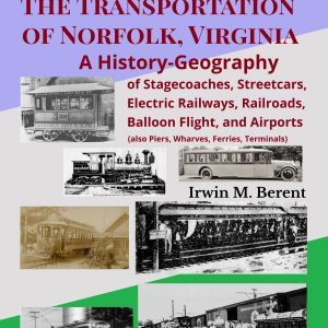
The Transportation of Norfolk, Virginia: A History-Geography (Book 8, Encyclopedia of Norfolk, Virginia, History-Geography) Norfolk covers in exhaustive detail the history-geography of the transportation of Norfolk, Virginia.
The Transportation of Norfolk, Virginia includes Norfolk's stage coaches, streetcars, electric railways, railroads, balloon flights, airports, piers, wharves, terminals, and more, all told through contemporary historic maps, photographs, articles, deeds, advertisements, books and other documents – making for an excllent reference and resource for a great city's transportation systems from its earliest times.
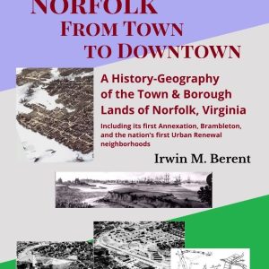
Norfolk, From Town to Downtown: A History-Geography of the Town & Borough Lands of Norfolk, Virginia (Book 9, Encyclopedia of Norfolk, Virginia, History-Geography) covers the history-geography of the oldest areas of Norfolk – the areas that were the original town as of 1635, then expanded in 1736 (when it became a borough), and expanded again in 1750, 1761, and the early 1800s, becoming the original city in 1845. It also covers the lands located just east of the original city, known as Brambleton and Mayfield, which were absorbed into the city by its First Annexation in 1887.
The areas discussed include locations once known as Back Creek, Glebe Cove, Dun In The Mire, Four Farthing Point and Old Fort, Town Point, Town Bridge, Plume's Cove, Brigg's Point, Allyntown, Musketo Point, Selden's Point, Lamb's Point, Salters Plantation, Hickory Neck, Boush's Pasture, James' Corner, etc. – in addition to Bramble's Point, Mahone's Lake, the Racefield, the Hemenway School, and Highland Terrace in Brambleton.
These early areas, which ultimately became the downtown of later, ever-expanding Norfolk, include neighborhoods later created by Redevelopment in some of the nation’s first Urban Renewal projects, such as Calvert Park (today's Calvert Square), Young Park (today's Young Terrace), and Tidewater Park (today's Tidewater Gardens) – in addition to the Central Business District, Freemason Harbor, et cetera.
Norfolk's First Suburbs Northward is a specially-priced volume that contains Books 10 and 11, all together, in one book totaling 165 pages, containing all the following:
Book 10. Norfolk's Huntersville, Lindenwood, and Villa Heights: A History-Geography of Virginia Suburbs Description of Book 10 Contents
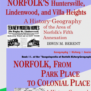
Norfolk's Huntersville, Lindenwood, and Villa Heights: A History-Geography (Book 10, Encyclopedia of Norfolk, Virginia, History-Geography) covers in exhaustive detail the areas of Norfolk’s Fifth Annexation (1911) – areas known as Huntersville, Outtensville, Barboursville, Lindenwood, Villa Heights, etc., including areas earlier known as North End, Hallsville, Woodland, Farmingdale, West Point, Elmwood, Sycamores, Borderville, Wetwood and Ward's Farm, Oak Hall, the Old Fairgrounds, Hankins' Cottage Place and the Linden (River), Villa Park, Elizabeth Heights, Riddick Heights (Barboursville), Springfield and Whitehead's Pond and Ridley's Pond, East End Heights, Georgetown and George Oldfield's brickyards, Lincoln Heights, etc.
Each is described through contemporary historic maps, photographs, articles, deeds, advertisements, books and other documents.
Book 11. Norfolk, From Park Place to Colonial Place: A History-Geography of Virginia Suburbs Description of Book 11 Contents
Norfolk, From Park Place to Colonial Place: A History-Geography (Book 11, Encyclopedia of Norfolk, Virginia, History-Geography) covers in exhaustive detail the history-geography of all the areas within Norfolk's Third Annexation, the Park Place Annexation of 1902, a vital part of what has made Norfolk, Virginia, one of America's most historic and important cities.
Norfolk, From Park Place to Colonial Place encompasses the lands located mainly north of the previously annexed territory (Atlantic City and today's Ghent) and abutting the southern side of much of the Lafayette River (formerly Tanner's Creek), areas known as Park Place, Virginia Place, Cruser Place, Riverview, Lafayette (City) Park, Colonial Place, Old Dominion Place, Bungalow Park, Kensington, Highland Park, and so on, lands once identified as the North End, the J.R. Young strawberry farm (said to have been the largest in the world), the lands of R.H. McDonald (temperance advocate and purveyor of California Vinegar Bitters), Riverside Park, Riverview Park, etc.
Their stories are told through contemporary historic maps, photographs, articles, deeds, advertisements, books and other documents.
Norfolk's First Suburbs Westward & Southward is a specially-priced volume that contains Books 12 and 13, all together, in one book totaling 165 pages, containing all the following:
Book 12. Norfolk's Atlantic City — or Ghent — and Lambert's Point: A History-Geography of Virginia Suburbs Description of Book 12 Contents
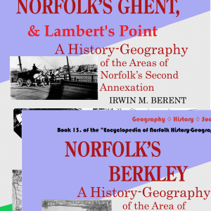
Norfolk's Atlantic City — or Ghent — and Lambert's Point: A History-Geography (Book 12, Encyclopedia of Norfolk, Virginia, History-Geography) covers in exhaustive detail the history-geography of the areas of Norfolk's Second and Sixth Annexations.
The book encompasses the lands located just west of the original city, areas known as Atlantic City, Ghent, East Ghent and West Ghent, the Hague, Fort Norfolk, and so on, lands once identified as Pleasant Point, Pattenween and the Thistle Distillery, Tomoko, the West End, Washington Creek, Jerusalem farm and Armistead's Ropewalk, Llewellyn manor, Ribble Place, Lee Park, Williamston, Eureka Property, Pennock's Point, Tarrant's Creek/Edmond's Creek, the Core Property, etc.
It also encompasses the lands of the Lambert’s Point Annexation, Norfolk’s Sixth Annexation (1911), located north of the eastern section of the Atlantic City Annexation. Named for the point of land jutting into the Elizabeth River and long known as Lamberts Point (and earlier said to have been called Hornet's Point), it includes the site of the Lambert's Point coal terminals and spans from the Elizabeth on its west to 49th Street on its north.
Their stories are told through contemporary historic maps, articles, deeds, advertisements, books and other documents that make this a magnificent resource.
Book 13. Norfolk's Berkley: A History-Geography of a Virginia Suburb Description of Book 13 Contents
Norfolk's Berkley: A History-Geography (Book 13, Encyclopedia of Norfolk, Virginia, History-Geography) covers the history-geography of all the areas within Norfolk's Fourth Annexation, the Berkley Annexation of 1906.
Separated from the original city of Norfolk to its north by the Eastern branch of the Elizabeth River, and from Portsmouth to its west by the Southern branch of the Elizabeth, Berkley was earlier known as Washington Point, Powder Point, Ferry Point, or Herbertsville, and also includes areas known as St. Helena, Montalant, Ottley Place, and so on.
Norfolk's Berkley tells their stories through contemporary historic maps, photographs, articles, deeds, advertisements, books and other documents.
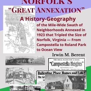
Norfolk's "Great Annexation": A History-Geography of the Mile-Wide Swath of Neighborhoods Annexed in 1923 that Tripled the Size of Norfolk, Virginia – From Campostella to Roland Park to Ocean View (Book 14, Encyclopedia of Norfolk, Virginia, History-Geography) covers in exhaustive detail the history-geography of all the lands within Norfolk’s Great Annexation of 1923 – which tripled the size of Norfolk, taking in more than half of what remained of Tanner's Creek Magisterial District (the designation given to the part of Norfolk County north of the Eastern Branch of the Elizabeth River).
The vast territory of the Annexation covered an approximately mile-wide swath running from the area known as Campostella (located east of Berkley), northward along the western side of Virginian Railroad tracks towards the area of today's Roland Park, Suburban Acres, and other subdivisions, where it extends northwestward to take in nearly all the lands north of the Lafayette River (as well as the sections known primarily as Edgewater and Larchmont on the southern side of the Lafayette). (Also in the northwestern section are the lands of the Naval Base and what was once the Army Base, both lands covered in this book.) The northernmost areas extend along the Elizabeth River, Hampton Roads, Willoughby Bay, and the Chesapeake Bay and include West Ocean View all the way to what was the Princess Anne County line.
The following neighborhoods are in the area that this Annexation included – all areas covered in Norfolk’s “Great Annexation” and all described through centuries of contemporary historic maps, photographs, articles, deeds, advertisements, books and other documents:
Albemarle, Alfalfa Farms, Algonquin Park, Atlantic Park, Baecher Point, Ballentine Place, Bay View Beach, Bay View Beach, Bay View Forest, Bay View Manor, Bay View Park / Bayview Park, Bell Farms, Belmont Place, Belvedere, Benmoreell, Blairgowrie, Bolling Square, Bollingbrook, Bondale, Bonthorpe Farm, Boulevard Homes, Boulevard Park, Boulevard Terrace, Boush's Bluff, Bowling Green (earlier Bowling Park), Breezy Point, Broad Creek Village, Broaddus Manor, Bruce Park, Campostella, Campostella Heights, Cape View Colony, Carney Park, Chelsea, Chesterfield Heights, Collins Terrace, Colony Point, Conway Heights, Conway Place, Cottage Heights, Cottage Line, Cottage Park, Cottage Place, Cromwell Farm, Daniels Gardens, Diggs Park (Diggs Town), Douglas Park, East Campostella, East Ocean View, Edgemere, Edgewater, Edgewater Haven, Edgewater Terrace, Ellsworth, Euwanee Park, Fairmount Manor, Fairmount Park, Fairwater, Glen Echo Shores, Glencove Links/Glencove Estates, Glenhaven, Glenview, Glenwood Park, Gowrie Park, Granby Park, Granby Shores, Grandy Village (earlier Grandy Park), Gray Manor, Halstead Park, Hampton Court, Hampton Court, Hampton Gardens, Hariton Gardens, Haynes Tract, Holland Park, Holly Point, Hyde Park Homes, Kenilworth, Kenilworth, Kent Park, Lafayette Annex, Lafayette Residence Park, Lafayette Shores, Lafayette Terrace, Lakewood (originally to be called Lakehurst), Larchmont, Lebanon, Lenox, Lewis Park, Liberty Park, Little Bay, Loch Haven / Lochaven / Lochhaven, Logan Park, Marshall Manor, Mason Manor, Meadowbrook, Meadowbrook Gardens, Merridale, Merrimack Landing (earlier Merrimack Park), Middle Town Arch, Monkey Bottom, Morningside, Moton Park (later Moton Circle), Naval Base, Naval Terrace, Newport Homes, Newton Park, North Edgewater, North Larchmont, North Meadowbrook, North Shore Gardens, North Shore Park, North Shore Point, Oak Grove Point, Oakdale Homes, Oaklawn, Oakleaf Gardens, Oakleaf Park, Ocean View, Ocean View Residence Park, Oceanair, Pamlico, Pamlico Villa, Pinehurst/Academy Terrace, Pinewell, Point Willow / Willow Point, Pomfret, Restmere, Riverfront, Riverpoint, Riverside, Riverside Terrace, Roberts Park East, Roberts Village (earlier Roberts Park), Roland Park, Rose Gardens, Sandy Point, Sarah Constant Beach, Sewell Park, Sewell Park, Sewell's Point, South Edgewater, Stone Bridge Crossing, Stratford Court, Studeley Place, Suburban Acres, Suburban Park, Sunshine Homes, Sussex At Norfolk, Talbot Hall, Talbot Park, Tatemsville, The Cedars, The Pines, the Quarantine House, Titustown, Virginia Estates, Virginia Gardens, Walbrook, Washington Heights, Waterlawn, Wellington Homes, West Belvedere, West Fairmount Park, West Larchmont, Westchester, Westmere Estates, Westminster Homes, Westmont / Commodore Park, Wexford Terrace, Willard Park, Willoughby Beach, Willoughby Spit, Willow Terrace, Windsor Point (originally Philpotts Point), Winona.
These include areas once known as Baum's Retreat, Tatemsville, The Cottage/Sycamore Cottage/Cottage Farm, Glenair, the Parish Land, Stephens Point, Guy's Woods, Simmons Farm, Norfolk-On-The-Roads, Pine Beach, Vue d'Leau, White City, Jamestown Exposition, Glen Conway, Seven Oaks, Thelaball's Creek, Willoughby Point, Taylor Farm, Darby's Creek, Willoughby Military Reservation, and so on.
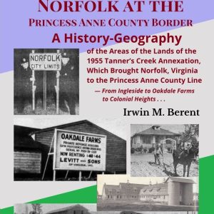
Norfolk at the Princess Anne County Border: A History-Geography of the Lands of the 1955 Tanner's Creek Annexation, Which Brought Norfolk, Virginia to the Princess Anne County Line – From Ingleside to Oakdale Farms to Colonial Heights, Norfolk’s 8th Annexation (Book 15, Encyclopedia of Norfolk, Virginia, History-Geography) covers in exhaustive detail the history-geography of all the lands within the 1955 Tanner’s Creek Annexation – which brought the city of Norfolk’s boundary to the Princess Anne County line.
Nearly as large as the previous ("Great") Annexation, this Eighth Annexation took in all that remained of the Norfolk County lands, then known as Tanner's Creek Magisterial District. The following neighborhoods are in the area that this Annexation included – all areas covered in Norfolk, Virginia, West of the Princess Anne County Line and all described through centuries of contemporary historic maps, photographs, articles, deeds, advertisements, books and other documents:
Alden Heights, Azalea Terrace, Brandon Place, Brentwood Forest, Broad Creek Shores, Broad Creek Village, Brock Tract, Brookfield Park, Carrolton Place, Cherokee Heights, Chesapeake Manor, Chesapeake Manor Gardens, Coleman Place, Colonial Heights, Coronado, Cottage Road Park, Cresthaven Homes, Denby Park, Devon Manor, Dunning Heights, East Coleman Place, East Fairmount Park, East Norview, Elizabeth River Point, Elmhurst, Estabrook, Estabrook Gardens, Estabrook Park, Estabrook Shores, Forest Park, Forrest Lawn, Fox Hall Dairy, Fox Hall Gardens, Fox Hall Manor, Fox Hall Place, Fox Hall Point, Fox Hall Residence Park, Gay Manor, Green Hill Farms, Greenwood / Greenwood Park, Greenwood Place, Grove Park, Hertford Place, Inglenook Park, Ingleside, Ingleside Heights, Ingleside Manor, Ingleside Shores, Ingleside Terrace, Ionia, Kennebeck Heights, Lansdale, Lansdale Gardens, Lincoln Park, Malmgren Court, Mamie Homes, Marshall Manor, Meadowbrook Woods, Monticello Village, Norfolk Commerce Park (formerly Robin Hood Apartments), Norfolk Gardens, Norfolk Industrial Park, North Fox Hall, North Ingleside, North Ingleside Manor, Norva Homes, Norvella, Norview, Norview Annex, Norview Heights, Norview Terrace, Oakdale Farm, Oakdale Farms, Oakmont North, Oakwood, Oakwood Crossing, Oakwood Park, Oakwood Terrace, Overbrook, Oxford, Pennsytown, Princess Anne Park, River Oaks, Riverside Park, Rosedale, Rosemont, Sewells Gardens, Sherwood Forest Gardens, Sherwood Heights, Snug Harbor, South Bay View, South Ingleside, St. Andrews Place, Tipperton Place, Tucker Place, Washington Park, Wedgefield Park, West Estabrook, West Fox Hall, West Ventosa.
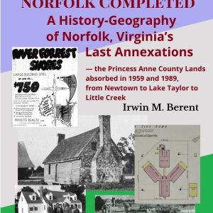
Norfolk Completed: A History-Geography of Norfolk, Virginia's Last Annexations – The Princess Anne County Lands Absorbed in 1959 and 1989, from Newtown to Lake Taylor to Little Creek (Book 16, Encyclopedia of Norfolk, Virginia, History-Geography) covers in exhaustive detail the history-geography of all the areas within Norfolk's Ninth Annexation (1959) – which took in a large chunk of the Kempsville Magisterial District of then-Princess Anne County – and the 1989 acquisition of the small remaining, eastern portion of East Ocean View.
The following neighborhoods are in the area that this Annexation and the acquisition included – all areas covered in Norfolk, Virginia’s Final Annexation and all described through centuries of contemporary historic maps, photographs, articles, deeds, advertisements, books and other documents:
Ventosa, Elizabeth Park, Sand Bay Point, Poplar Halls, Bell Cove, Magnolia Cove, River Forrest Shores, Rolleston, Wayside Manor, Glenrock, Janaf, Newtown, Pleasant Point, Easton Place, Davis Corner, Crown Point, Lake Terrace, Admirality Acres, Fairlawn Estates, Dewberry Acres, Maple Halls, Hollywood, Lansdale, Moore’s Bridges, Lake Taylor, Camden Heights, Azalea Shores, Azalea Acres, Azalea Lakes, Bromley, Lakeland, Little Creek Lakes, Glengariff, Wilburn Farms, East Point, Meadowbrook Terrace, Meadowbrook Forest, Hunt Club Point, Larrymore Lawns, Saratoga, East Lynne, Camellia Acres, Camellia Shores, Heritage Point, Parktown, Bel-Aire, Hewitt Farm, Wedgewood, Tarrallton, Roosevelt Shores, Larrymore Acres, Roosevelt Gardens, Camellia Gardens, Bay Cove, Delmar Shores, East Ocean View, Bratten Place, Pretty Lake, East Beach, Bay Oaks Place, Bay Breeze Point, and other neighborhoods and locales.